San Jacinto Peak - 10804'
Location: 33.81440°N, 116.6783°W
Stats
Date: 11/15/2009
Distance: 12 miles
Elevation gain: 2500'
Class (difficulty): 1
Time: 4 hours, 30 minutes
Range: San Jacinto
Prominence: 8319'
Partner(s): N/A
Report:
I was heading to Los Angeles for Microsoft PDC (a programmer convention). I knew LA had some cool peaks surrounding it, so I started investigating and decided to bag San Jacinto Peak and Mount Baldy.
San Jacinto Peak is located near Palm Springs, California. San Jacinto Peak is 10804’ feet high and is the highpoint of both the San Jacinto Mountains and Riverside County. The peak towers above the surrounding valleys and has 8319’ feet of prominence, making it the 6th most prominent peak in the lower 48 states. John Muir wrote the following “The view from San Jacinto is the most sublime spectacle to be found anywhere on this earth!”. After reading all of those facts, I had to do the peak!
The peak is accessed in all directions by trails, with the easiest route coming in from a tram station at 8500’. I was arriving in LAX at 9:45am and had a 2-hour drive to get to the base. No option other than the tram station route was going to work for me. Even if the timing of the plane, getting a car rented, and traffic to Palm Springs went perfect, I still only would have about 4 hours of daylight for a 12-mile hike with 3000’ of gain. Luckily I threw a headlamp into the pack before departing.
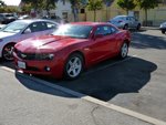
Of course the plane was late getting in. Then it took longer than expected to get a rental car. However, at 11am I was sitting in a red, 2010 Camaro. Normally I end up with POS cars like a PT Cruiser, but this time I was styling.
I usually do well in with directions and traffic, but Los Angeles was my biggest challenge to date. However, getting out of the LAX area and onto the freeway heading to Palm Springs was without issue and I was on my way.
In a little under 2 hours I was at the parking lot for the tram station. Then I had to wait on a bus to load to take us from the lot to the tram. Nothing like being in a hurry and waiting on little old ladies and people trying to load strollers with screaming kids kicking them.
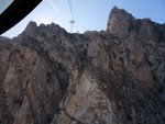
Finally we left the tram station at 1:15. The ride of the tram is incredible. You leave the Palm Desert at 2000’. The tram takes you up 7000’ feet in about 5 minutes. Most of the ride up is amongst huge rock cliffs. In the 5 minute ride, the terrain goes from desert cactus to a pine forest. The tram floor rotates so you are always looking from a new aspect.
After spending $20 quick bucks on food for the hike, I knocked down 3 blue hairs and 2 snot-nosed kids and hit the trail at a fast pace at 1:30pm. I found the ranger station where I needed to get my backcountry permit and signed in. I made the mistake of not taking a copy of the permit. Of course, 10 minutes into the hike I ran into Ranger Rick’s nephew on the trail. Ranger Ricky wanted to see my pass. Since I didn’t have a copy, he needed to radio the ranger station to verify I submitted one. After that was complete, he allowed me to go after asking me if I had a headlamp, food, extra clothes, etc… “I am from Idaho dude, I know what I am doing” was the response that seemed to do the trick. Off I was going after that brief slowdown.
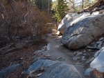
The trail was beautiful. It wound through old growth pines and firs with large boulders strewn about. The weather was perfect… blue skies, warm, and light winds. I made great time, beating my estimates to each landmark, but noting the lowering sun to my west. I was a bit relieved to see a lot of people on the trail, so I knew at least I wouldn’t get lost in the dark alone.
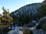
After a few miles, a few inches of snow was on the ground. Other than a few icy sections on the rocks, the snow had melted off the trail itself. After 2:15 minutes of hiking, I stood on top of the peak.
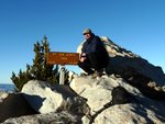
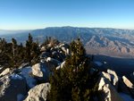
The views were as advertised. The view of the desert to the northeast and east was incredible. The western view was great as well. All views were enhanced by the setting sun. I hung out on top with a threesome from Spokane, Washington that had done the 10,000’ climb up the Cactus to Clouds trail. How about that for a day!
After chatting with them and some photos, I was getting chilly and needed to get moving to avoid too much nighttime travel.
I left the top around 4pm. After descending to a junction at 9400’, the sun went below the horizon. It was cold and getting dark quickly. I hiked until about 5:00pm before it got too dark and I needed my headlamp. With the headlamp on, I continued on. As the hike wore on, the temp got warmer and warmer. I also kept finding new landmarks and could see the light on the tram station, which gave me some comfort. Right around 6pm I arrived at the tram station. My summit partners arrived shortly after. The ride down the tram gave me gorgeous views of the lights 8000’ below in Palm Springs and was a great ending to a whirlwind tour of the peak.
Instead of rushing up Mount Baldy the next day on another day with limited time, I decided to hang out at plush hotel for the morning.
Getting There:
Traveling eastbound on Interstate 10 exit Highway 111 to Palm Springs, travel
8 miles to the first signal and turn right at Tramway Road. The Valley Station is located approximately 4 miles up Tramway Road.
|
|
Photos
 |
 |
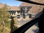
| Just leaving the lower tram station. |
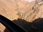
Lookind down at the lower tram station. |
 |
 |
| On the Palm Springs Aerial Tram. |
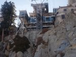
Arriving at the upper tram station. |
 |
 |
| The trail after I had gone a mile or two. Very neat terrain |
Nearing the summit. |
 |
 |
| Me on the summit. |
Looking north from the summit. |
 |
 |
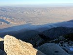
| Rows of wind mills beneath the peak. |
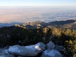
The city of Palm Springs. |
 |
 |
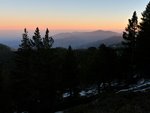
| San Gorgonio Mountain. Highest in SoCal |
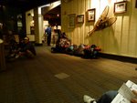
Hikers and hiker's gear at the upper tram station. |
 |
 |
| My rental... a 2010 red Camaro! |
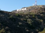
The famous Hollywood sign. |
|

